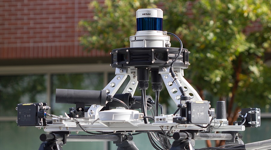
Healthcare facilities managers can use light detection and ranging (LiDAR) to create detailed three-dimensional models of a facility’s interior or exterior. As a remote measurement tool, LiDAR can quickly collect millions of datapoints with accuracy to a fraction of an inch at a standoff distance of tens to hundreds of feet within a few minutes.
While a variety of industries have used this technology, its capabilities make it a valuable investigation and documentation method in facility management and maintenance.
Understanding LiDAR
Healthcare facility managers can use the spatial and spectral — visual color — data collected with LiDAR to analyze various building and site features, including floor flatness and condition assessments, drainage analysis of parking lots and roofs, and investigations into wall plumbness and façade integrity.
LiDAR provides a quantifiable and visual record of the site at the time of the scan, so it is valuable as a tool for general site documentation, and it is one of the first steps in creating a building information model (BIM).
Many issues that a facility manager must address have components that are:
- Spatial — How big? How much?
- Visual — What does it look like? How does it differ from its surroundings?
- Temporal — What changes have occurred over a length of time?
These components define the extent of the issue or the possible remediation. Managers can use LiDAR and other imaging methods to answer these questions, though to what extent is important to understand.
LiDAR applications
Managers can create three-dimensional models of buildings in several ways, but LiDAR is a preferable means due to its capabilities. LiDAR — ground-based or attached to aerial platforms — physically measures the distance to an object using the two-way travel time of a laser pulse. The result is more accurate data collection compared to other methods.
LiDAR has a limited ability to image through some permeable obstructions because the device records multiple pulse reflections from beams that penetrate the obstruction from an angle or through small openings. But LiDAR can collect data from a spherical space around the device, not just the focal range of a camera, which allows it to capture more data than just the focus of the investigation and create a more complete model of the site.
The accuracy of LiDAR allows for repeatable measurements of a site, so one site can be scanned at different points in time and compared to one another to determine changes to the space over time. This 4D analysis can help managers determine rates of change to a site or its features. This same principle allows for LiDAR data to be compared to 3D models of a site created in drafting programs.
By comparing the model to the existing conditions documented by the LiDAR, managers can identify potential construction issues at critical junctures or discover distress. The spectral or visual data can be valuable for managers in documenting intentional facility features, such as parking lot markings, and unintentional features, such as discoloration due to ponding water. From this analysis, managers can estimate the area of an affected surface or determine the amount of a product needed for restoration.
Managers also can use LiDAR data for general site documentation by creating a digital copy of the space. This digital copy allows managers to bring the site to the expert instead of bringing the expert to the site, facilitating a digital walk-through of the area. Multiple people also can view the data simultaneously without direct interaction.
Advances in computer processing have made machine learning (ML) and artificial intelligence more available to consumers. In the application to facility management and maintenance, the use of ML requires that the software be able to visualize the site for development, training and analysis, so the site must be converted from a physical form into a digital form that can be understood by the computer.
LiDAR does just that, and while the application of ML to a particular practice or field of work is a complex process, converting the physical world into a digital version is the first step. As the use of ML becomes more ubiquitous, this conversion process will be in growing demand.
To scan or not to scan?
Facility managers and building owners should consider a number of factors when deciding whether to conduct a LiDAR scan:
- Has a major event occurred in the facility’s history, such as a change in ownership or use, a planned renovation or a catastrophic event leading to damage, or has there been a change in status, such as designation as a historical site? This also could include changes in how the facility is managed. Managers should conduct LiDAR scans to document the facility’s condition at the time of the event to serve as a baseline for future investigations should they be required.
- Has there been gradual or minor distress noted? Managers can use LiDAR to identify the distressed regions, because these could extend beyond those visually observed, and to quantify them.
- What is the area of interest at the facility? Is it in the interior of the site or the exterior or both? Is the area accessible to a person? What is the overall size of the area of interest? The answers to these questions will dictate if LiDAR is the best method of data collection and, if so, the way the data will be collected. These factors also will inform the time it takes to conduct the scan, which is a budget consideration.
- What is the scope of the work? What is the resolution needed by the data? Will there be repeated measurements over time? If the objectives of the investigation require accuracy down to the fraction of an inch and are focused on minute features or multiple measurements of the site conducted over time — 4D analysis — then managers must use LiDAR to produce reliable results.
LiDAR’s collection speed and standoff distance, accuracy and data density have made it a valuable asset in facility management and maintenance. Managers can use it to solve complex spatial problems, from building distress to design, or as a method of documenting a site for future use or stakeholder communication. Its ability to digitize a site allows for a multitude of analyses currently available to the market, and it provides a method to incorporate new, innovative applications, such as machine learning, being developed for future use.
Robert Hendricks is the senior staff geophysicist for the facilities group at Terracon’s Dallas office.
 What Does Light Daily Cleaning Miss in Patient Rooms?
 Smart Lighting Overhaul Boosts Efficiency, Diagnostics and Wellness at Bryan Health
 AdventHealth Opens New Freestanding ER in Florida
 Dirty Floors: How Pathogens Can Accumulate and Spread Underfoot
 WellSpan Health Opens Its Newberry Hospital in Pennsylvania